
![]()

![]()
![]()

![]()
![]()
![]()
![]()
![]()
![]()
![]()
![]()
![]()
![]()
![]()
![]()
![]()
![]()
![]()
![]()
![]()
![]()
![]()
![]()
![]()
![]()
![]()
![]()
![]()
![]()
![]()
![]()
![]()
![]()
![]()
![]()
|
Recommends...
 By Andrew Doughty and Harriett Friedman. Excellent guidebook. Much better than the Lonely Planet series, since it gives opinions. Good, detailed information for hiking and snorkeling. |
 mauna_kea
|
|
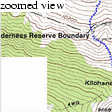
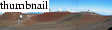
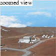
At first appearences, it would seem that the entire island conspires against tourists visiting Mauna Kea, home to a slew of large telescopes. Rental car companies void insurance coverage for travel not only on the (excellent) part-dirt road to Mauna Kea's summit, but also on Saddle Road, a paved thouroughfare that conveniently bisects the island from Waimea to Hilo. Moreover, from Saddle Road, there was not a single sign to direct us to the Ellison Onizuka Visitor Center, which at 9200 feet is the usual starting point for Mauna Kea climbers. A friendly ranger, Kalini, tells us that the missing sign was no conspiracy, but likely due to thieving astronomy students from University of Hawaii-Hilo.
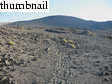
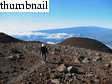
Kim and I were the first to park at the Onizuka Visitor Center, at around 07:30. We made use of the excellent bathroom facilities and were ready to start hiking, until Kalini started chatting with us. Eventually, he offered to drive us to the summit! We politely declined, but compromised by riding to the boundary of the Mauna Kea Ice Age Reserve, at 10000 feet elevation, where there is a road turn-out. We started hiking at around 08:00, as I recall. From there, the trail climbs steeply for the next 1000 feet. A strong, consistent headwind slowed our pace, but also filled our lungs with much-needed air.
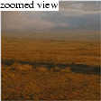
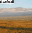
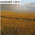
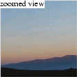
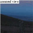
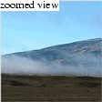
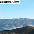
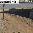
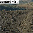
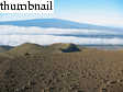
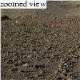
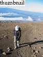
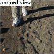
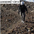
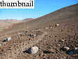
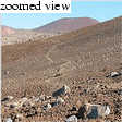
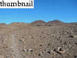
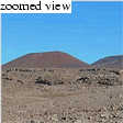
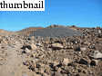
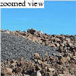
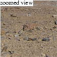
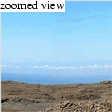
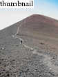
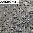
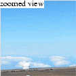
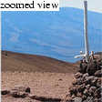
The close-up views along the trail were novel, but somewhat monotonous and boring. An endless moonscape. The distant views were equally novel, but absolutely enchanting. Mauna Loa plays tricks on one's perception. You know it's nearly as high as Mauna Kea (13677 feet), but for some reason it looks kind of insignificant from the trailhead. As you go on, however, it's still there, still the same size, and still higher than you are. At that point, you begin to realize how unimaginably bulky Mauna Loa is.
Kim and I have never suffered an obvious bout of altitude sickness, but we knew that this hike would test that precedent, as we would go from sea level to nearly 14000 feet in six hours. The day before, we went for a short, steep run at the 5000-foot-level on Hualalai Volcano near Kona. At the bottom of the Mauna Kea trail, we both took a dose of Ibuprofen. As we steadily pressed on, the strategy seemed to be working. I felt very strong, and Kim, though suffering at first, caught a second wind above 13000 feet for a strong finish.
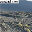
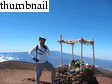
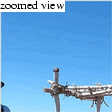
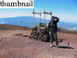
At 13100 feet, one comes again to the boundary of the Mauna Kea Ice Age Reserve at the Summit Road. By coincidence (or possibly not), Ranger Kalini was passing by just as we stepped onto the road. Again, he offered to drive us the remaining 600 feet to the summit, and again we declined. However, we gladly accepted his offer to drive us down from the summit. Any ego I stake on hiking such a mountain goes out the window for the descent! Anyhow, the standard procedure for hikers is to follow the (now paved) summit road to 13700 feet from the Reserve boundary. That we did, and reached the road's high point at something like 11:20. From there, it is a 100-foot descent to a saddle, followed by a steep 100-foot+ ascent to the true summit. Though chilly and windy, we enjoyed the views and the recent offerings placed on the summit altar by the Hawaiians for a Spring Equinox festival.
The ride down was enjoyable for many reasons. First, Kalini was great guy. I really enjoyed hearing a Hawaiian's candid take on the current state of Hawaii, its culture, and its citizens, rather than the candy-coated story one might read in (for instance) the Volcanoes National Park visitor brochure. Second, neither of us was relishing the tedious, time-consuming descent back to our car. In fact, we were just finishing a fantastic lunch at the Koa House Grill in Waimea when we otherwise would have been arriving back at our rental car.
All-in-all, I highly recommend Mauna Kea as a hiking destination. Of all the high peaks I've climbed in the US, the trail to the summit is of a high quality, and makes the otherwise-daunting 4600-foot elevation gain pass that much faster.
|
| ||
|
|
|

|


|

|

|
|
|
|
|
|
|
|

|
|
|
|
|
|
|
|

|

|
|
|

|
|
|

|
|
Department of Geophysics Stanford University |

|