


The Sea of Galilee data set has enchanted my colleagues and me because the data has comprehensible defects that have frustrated many of our image estimation designs. The best results found so far were prepared for us here by Antoine Guitton based on our 2004 Geophysics paper.
We are given depth-sounding data from the Sea of Galilee. The Sea of Galilee is unique because it is a fresh-water lake below sea-level. It seems to be connected to the Great Rift (pull-apart) valley crossing East Africa. The ultimate goal is to produce a good map of the depth to bottom, and images useful for identifying archaeological, geological, and geophysical details of the water bottom. In particular, we hope to identify some ancient shorelines around the lake and meaningful geological features inside the lake. The ancient shorelines might reveal early settlements of archeological interest or old fishing ports. The pertinence of this data set to our daily geophysical problems is threefold: (1) We often need to interpolate irregular data. (2) The data has noise bursts of various types. (3) The data has systematic error (drift) which tends to leave data-acquisition tracks in the resulting image.
The Galilee data set was introduced in chapter ![[*]](http://sepwww.stanford.edu/latex2html/cross_ref_motif.gif) and recently plotted in Figure .
Actually, that figure is a view of 2-D model space.
One of the first things I learned (the hard way) is the importance
of viewing both the model space and the residuals in data space.
and recently plotted in Figure .
Actually, that figure is a view of 2-D model space.
One of the first things I learned (the hard way) is the importance
of viewing both the model space and the residuals in data space.
|
Be sure to plot both model space and data space. You should try to understand the results in both spaces and might like to watch movies of each as the iteration progresses. |
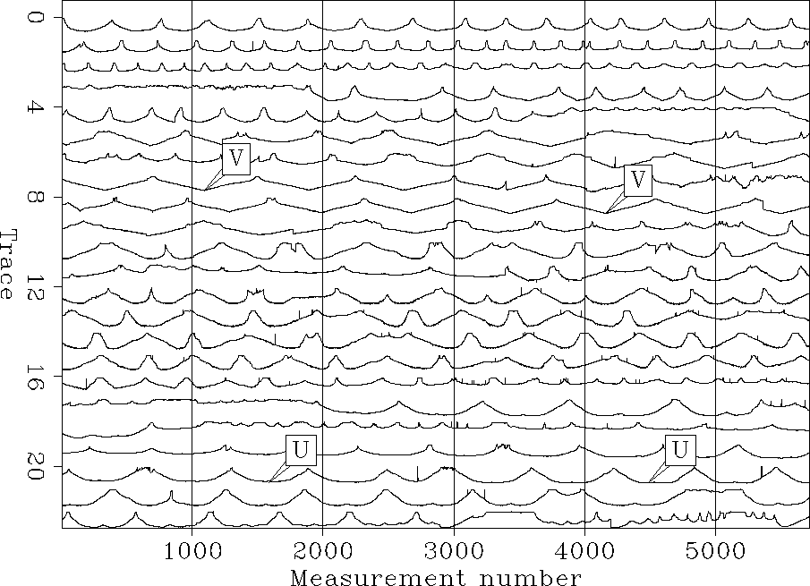
The raw data (Figure ),
is distributed irregularly across the lake surface.
It is 132,044 triples (xi,yi,zi), where xi ranges over about
12 km, where yi ranges over about 20 km,
and zi is depth in multiples of 10 cm.
(It would have been helpful if a fourth value had been included,
the clock-date time ti, of the measurement.)
The ship surveyed a different amount of distance every day of the survey.
Figure displays the whole survey as one long track.
On one traverse across the lake, the depth record is U shaped.
A few V shaped tracks result from deep-water vessel turn arounds.
All depth values (data points) used for building the final map are shown here.
Each point corresponds to one depth measurement inside the lake.
For display convenience, the long signal is broken
into 23 strips of 5718 depth measurements.
We have no way to know that sometimes the ship stops a little while
with the data recorder running;
sometimes it shuts down overnight or longer;
but mostly it progresses at some unknown convenient speed.
So the horizontal axis in data space is a measurement number
that scales in some undocumented way to distance along the track.
 |


