


The marine data are a 3-D DMO'ed poststack data volume acquired over a salt intrusion in the Gulf of Mexico, donated by Halliburton Geophysical Services to SEP. The test data set used here is a smaller portion of the complete data set. I am using 30,000 poststack traces binned on a 300x100 surface grid, with a decimated inline (300) spacing of 37.5 m and an original crossline (100) spacing of 25 m, representing a surface area of 11 km inline by 2.5 km crossline. The traces were decimated to 8 ms to save memory, without loss of signal bandwidth.
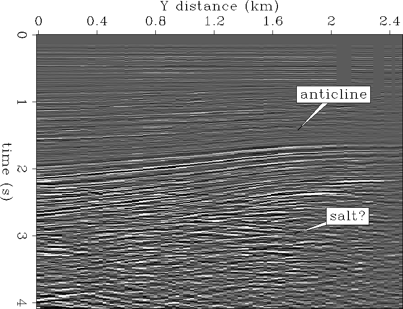
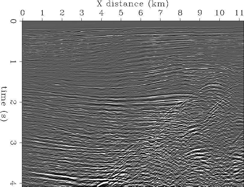
Figures ![[*]](http://sepwww.stanford.edu/latex2html/cross_ref_motif.gif) and show a crossline and inline
section respectively, sliced from near the center of the input stacked data
volume. The crossline section shows a sedimentary anticline over some
rough diffractions related to salt. The inline section shows fairly
gently dipping sediments abutting a region of steep dip diffractions and
reflections associated with salt-sediment interfaces.
and show a crossline and inline
section respectively, sliced from near the center of the input stacked data
volume. The crossline section shows a sedimentary anticline over some
rough diffractions related to salt. The inline section shows fairly
gently dipping sediments abutting a region of steep dip diffractions and
reflections associated with salt-sediment interfaces.
 |


 |