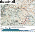
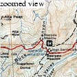
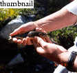
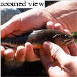
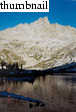
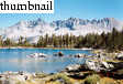
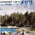
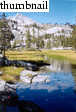
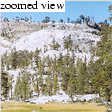
Big Arroyo backpack: three days from Mineral King to Crescent Meadow

Morgan Brown

Research
Adventures
Images
Scenery
California
Canada
Colorado
France
Glacier NP
Hawaii
Italy
Nevada
New Mexico
New Zealand
Norway
Oregon
Random
Sequoia/Kings Canyon
Alta Peak
Big Arroyo
Cedar Grove
Emerald Lake
Little Baldy
Moro Rock
Courtright
JMT 2005
black_kaweah
Texas
Utah
Yosemite
Virgin Islands
Kim & Morgan
Mom & Dad


Books that Morgan
Recommends...

The High Sierra: Peaks, Passes, and Trails

By R.J. Secor. The High Sierra hiking/climbing guidebook. Amazingly exhaustive. An indispensible trip planning aid.


In early September, 2001, Kim and I took a long backpacking trip from Mineral King to the Lodgepole area, via Big Arroyo. A memorable trip. Our concise itinerary: Mineral King, over Glacier Pass to Spring Lake, where we fished and dined. Moonlight hike over Black Rock Pass to Little Five Lakes, where we camped on night 1. Up Big Arroyo the next day, over Kaweah Gap, and down to Hamilton Lake for camping on night 2. We planned to go cross-country across the Tablelands, camp another night and pull into Wolverton the next day, but we instead just walked the long (17 miles), fairly flat stretch from Hamilton Lake to Crescent Meadow, where Robert picked us up. For additional details on this trip...a trip Report is here
Click on small images to start "slide show"
ba00-tripmap.jpg (443 KB)


ba01-sawtooth-pass-trail.jpg (101 KB)


The Sawtooth Pass trail winds ...
ba02-blackrockpass-from-glacierpass.jpg (85 KB)


View of the Black Rock Pass tr...
ba02a-morgan-glacier-pass.jpg (120 KB)


VMorgan going over the edge of...
ba03-from-glacier-pass.jpg (100 KB)


View to the southwest from Gla...
ba03a-spring-lake.jpg (114 KB)


Stunning view of Spring Lake a...
ba04-brook-trout.jpg (47 KB)


One of the four Golden Trout t...
ba05-gw-divide.jpg (78 KB)


Spring Lake and the Great West...
ba06-kim-spring-lake.jpg (81 KB)


Kim at our cooking spot on Spr...
ba07-black-rock-pass-west.jpg (75 KB)


Zoom view of the switchbacks o...
ba08-kim-on-black-rock-pass.jpg (49 KB)


Kim on Black Rock Pass (11,700...
ba09-little-5-lakes-camp.jpg (119 KB)


Stunning views of the Kaweah P...
ba10-little-5-lakes-kaweahs.jpg (102 KB)


View fof the Kaweah Peaks from...
ba11-stream.jpg (88 KB)


Clear stream on the way out of...
ba12-gw-divide-panorama.jpg (159 KB)


Panorama of the Great Western ...
ba14-big-arroyo-N.jpg (107 KB)


View to the north from the Big...
ba15-big-arroyo-S.jpg (91 KB)


View to south, down Big Arroyo...
ba16-knm-kaweah-gap.jpg (93 KB)


Kim and Morgan at Kaweah Gap, ...
ba17-precipice-lake.jpg (90 KB)


Precipice Lake from the High S...
ba19-precipice-lake-NW.jpg (63 KB)


View to northwest from Precipi...
ba20-hst-blasted.jpg (66 KB)


In some places, the High Sierr...
ba21-kaweah-gap.jpg (81 KB)


In the hike down Valhalla on t...
ba22-kim-cooking-hamilton.jpg (66 KB)


Kim cooking near our campsite ...
ba23-knm-kaweah.jpg (87 KB)


Kaweah Gap and the Great Weste...
ba24-long-day.jpg (59 KB)


The 17 miles we hiked on our l...


© 2006 , Stanford Exploration Project
Department of Geophysics
Stanford University

Modified: 10/15/06, 06:16:24 PDT , by morgan
Page Maintainer: morgan `AT' sep.stanford.edu