Next: BOTH MISSING DATA AND
Up: Multidimensional autoregression
Previous: SEABEAM: FILLING THE EMPTY
Figures
21
and
22
show synthetic and real surveys
containing regions where no data was recorded.
The PEF method of this book produces the extrapolated image in the upper right.
Notice that far from known data,
the extrapolated data is weak.
This is a result of a ``minimum variance'' calculation.
Notice the weak interpolated data also has a different spectrum
than the known data.
It lacks the short wavelength fuzz.
That's because the short wavelengths cannot be extrapolated long distances.
There is a simple way to acquire short wavelength fuzz at long distances
by adding random fuzz of the proper spatial spectrum.
This is what they do in Geostatistics.
We can also do it within the usual geophysical estimation framework.
Here is how we do it.
Given the usual data fitting and model styling goals
We introduce a sample of random noise and fit instead
these regressions
Of course you get a different solution for each different
realization of the random noise.
You also need to be a little careful to use noise of the correct variance.
Bob Clapp (thesis) worked out the correct scalar variance.
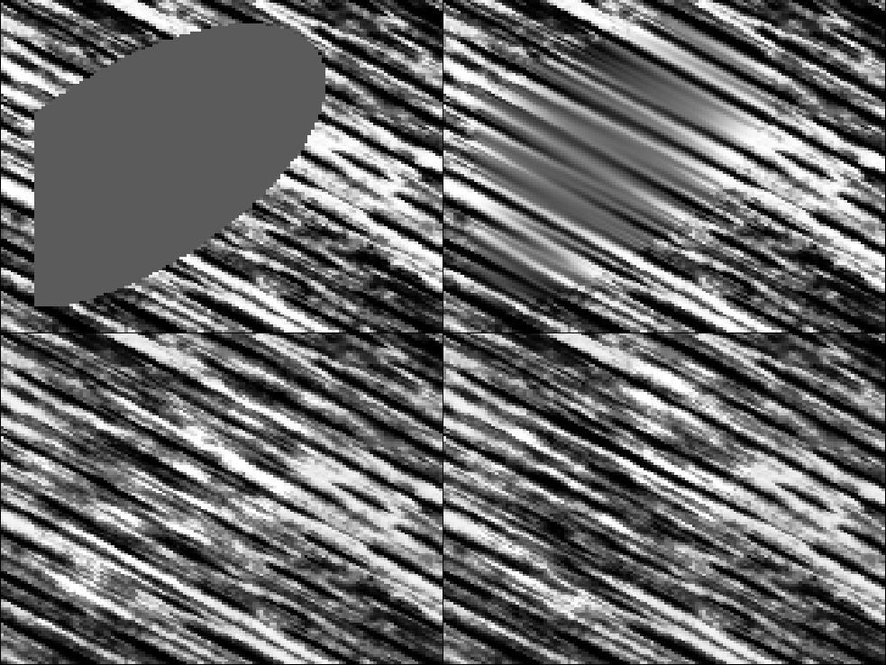
The wood image gives us the example in Figure 21.
manywood
Figure 21
Top left is wood with
a hole punched out.
Top right the hole filled with a PEF.
The bottom two are realizations with different
samples of noise . Notice they differ inside the hole.
![[*]](http://sepwww.stanford.edu/latex2html/movie.gif)


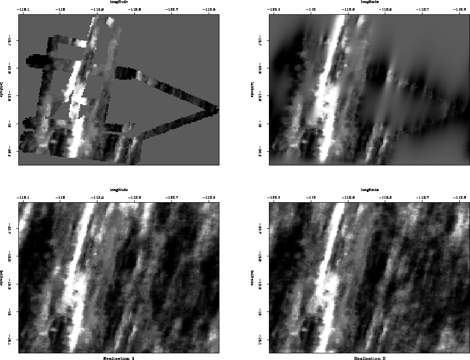
Figure 22 shows the same concept with
the seabeam data.
bobsea
Figure 22
Top left is binned data.
Top right extends the data with a PEF.
The bottom two panels add appropriately
colored random noise in the regions of missing data.
(Bob Clapp)
Next: BOTH MISSING DATA AND
Up: Multidimensional autoregression
Previous: SEABEAM: FILLING THE EMPTY
Stanford Exploration Project
12/15/2000